
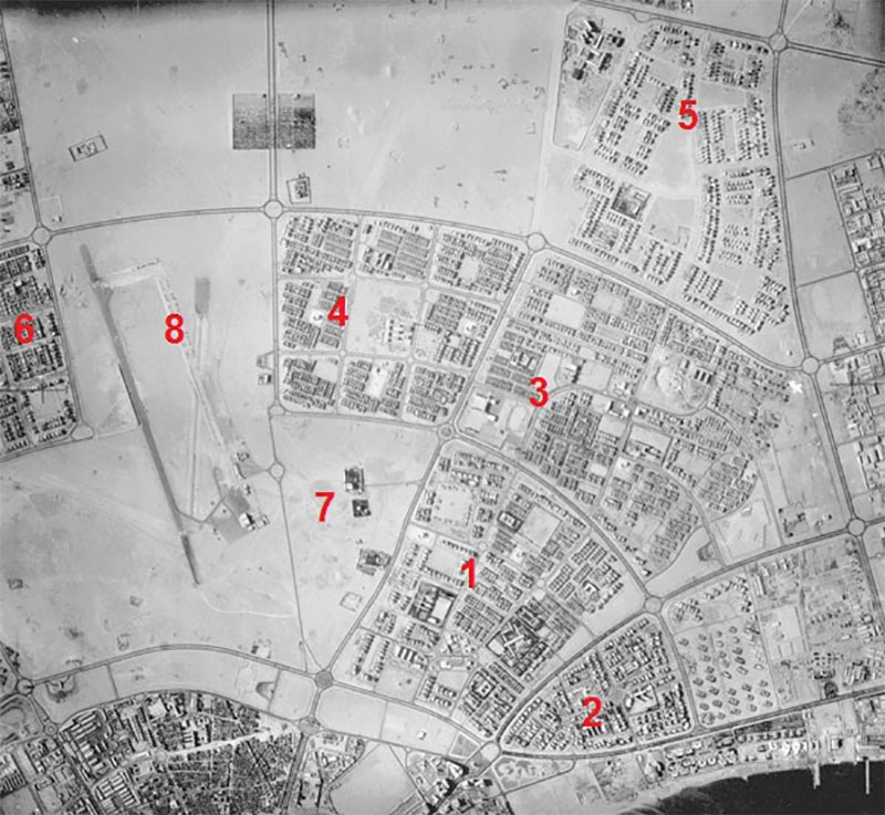
I got the photo above over WhatsApp. It’s an aerial photo of Kuwait from 1957 and the numbers correspond to the different areas below:
1- Al Shamiya
2- Shuwaikh
3- Kaifan
4- Al Faiha
5- Al Khalidiya
6- Al Qadsia
7- Al-Dahiya
8- Nuzha
#8 is the old airport that was located in Nuzha. I actually have a bunch of pictures of that airport which I got from the KOC Archive and you can check those photos out [Here]
8 replies on “Aerial Photo of Kuwait – 1957”
That looks like an aerial photo.
damn it thats the word I was looking for, will edit the post now
The map is upside down
Is Nuzha the same Nuzha near Kuwait city today? Just wondering what was built over the old airport haha.
Yup
Check out the 3rd ring road. It used to be all roundabouts
Hi Mark,
Where is KOC photo archive located?
At KOC