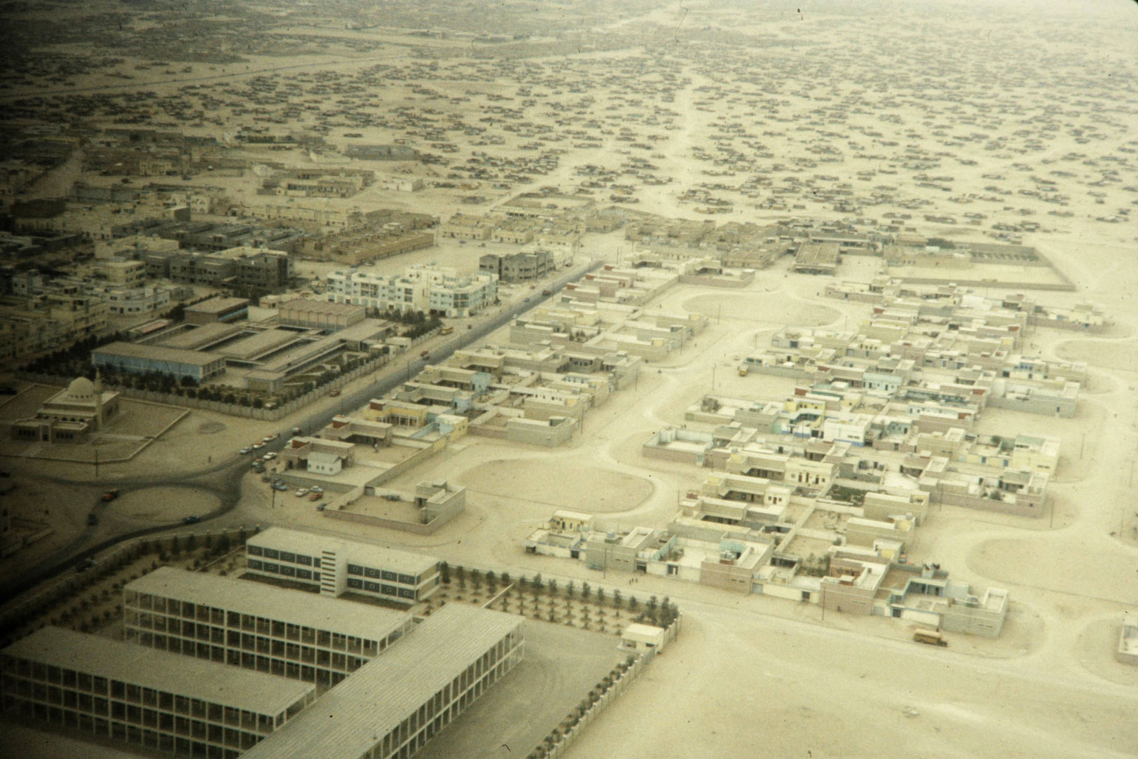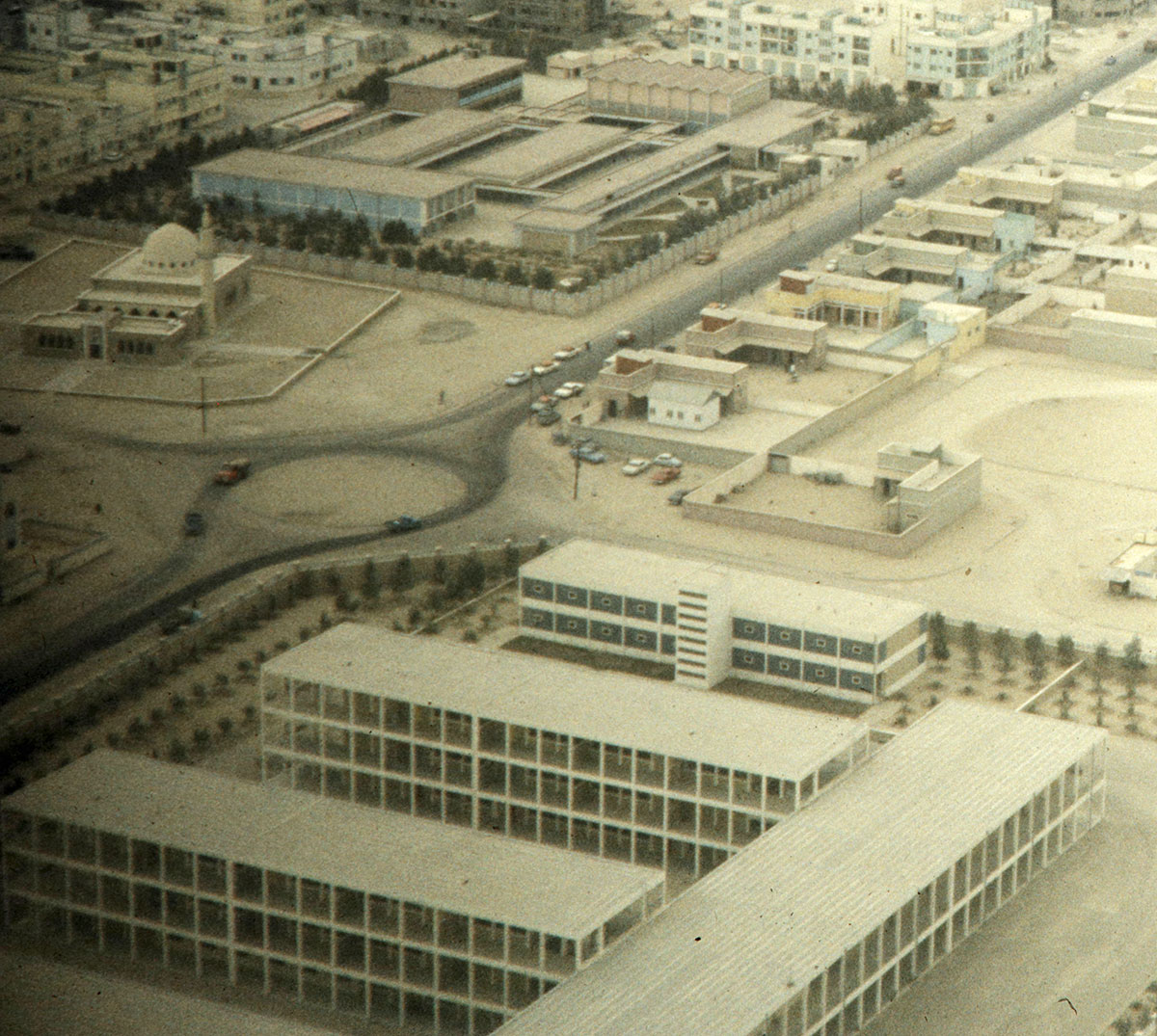
I found this old aerial photo of Kuwait taken in 1960 but I can’t figure out where that area is today. There are some major clues to help, the school on the bottom, the mosque across the street and what looks like another school behind the mosque.

All three structures should still be standing today but I couldn’t find a similar combo on Google Maps. If you’re bored and looking for something to kill time with today, help me find the location! Here is a link to the super high res copy of the image.

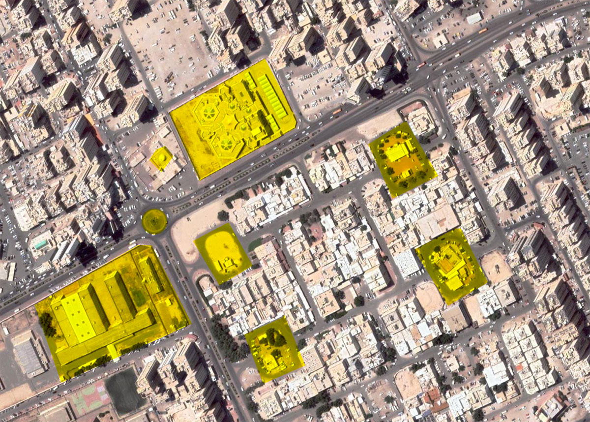
Update: With the help of a reader it looks like we might have found the location and it seems to be Farwaniya. Here is the link to the mosque on Google Maps and I’ve taken a screenshot of the map and rotated it to match the direction of the original photop=. I also highlighted all the similar areas that existed in the original photo and that still exist today. The old huts/shacks in the background of the original image look to be what today is Ishbilia and Jleeb Al-Shuyoukh.

27 replies on “Do you recognize this area?”
Seems like Al Rahman Mosque and Public Authority for Disabled at Beirut Street.
Check it out. https://www.google.com/maps/place/Beirut+Street,+Hawally/@29.3338366,48.0131347,392m/data=!3m1!1e3!4m5!3m4!1s0x3fcf9c85c77f2a6f:0x5d432a565906fdbe!8m2!3d29.3309942!4d48.0072592
I just checked, the authority for the disabled building looks completely different and then missing the second school behind the mosque.
the Al Rahman mosque is pointing towards the roundabout, whereas the mosque in this picture is pointing away.
I was going to say exactly the same place but I had doubt because of what Mark said..
Hi Mark,
This looks like the KU college campus in Adailiya
https://goo.gl/maps/TNnCc66qAdP5DUf96
Damn, that’s very similar but don’t think it’s it. The distance between the campus and the mosque doesn’t match and the distance between the mosque and the school behind it doesn’t match either. I found similar setups elsewhere in Kuwait, it’s like a template they applied in different parts of Kuwait as part of their urban planning back in the 60s. You’ll find setups that are close just not exactly the same.
Completely correct.
That’s a tough one. The school doesnt provide much info since most public schools are built in the exact same prison block system (main long building and extended wings in the shape of an E)
Building looks so similar as Shurifa Al Awadhi High School in Adailiya. The mosque and other building are not there, but maybe demolished? Mosques sometimes get demolishes if a new one is built instead, right?
Okay I take it back, too many schools look so similar
What are those artefacts in the background? Shrubs? Trees? Cars? Huts?
If you click on the high res photo link you’ll get a clearer view
https://248am.com//images/2021/06/agsphoto_40975_full.jpeg
they look like old shacks/huts
Finding more info on the blue residential looking building or more pics would help it look unique for its time
I thought of that but most likely those would have been demolished by now
I think it’s in Ahmadi.
Copy and paste in google: 29.086941545110516, 48.06783830372273
thats just a mosque, none of the other structures are there
True!
Maybe it’s worth checking the “historical imagery” option in Google earth pro. It will take you back in time to check old structure.
Wait what? Let me google how to do that 😳
I think the school behind the mosque is now Al Amal Indian School in Salmyia, the mosque is probably demolished and I think there is some hotel in its place. And the school on the roundabout is Anjafa school. The road layout and the roundabout seems the same. That’s my guess.
Just checked, Amal Indian School looks completely different. No second school and no mosque as well.
Is it actually a photo of Kuwait?
The remaining photos of the Harrison Forman collection of Kuwait in the link which Mark posted, shows canyons and rivers
https://collections.lib.uwm.edu/digital/collection/agsphoto/search/searchterm/al%20kuwayt!Harrison%20Forman%20Collection/field/countr!origin/mode/exact!exact/conn/and!and/order/nosort/ad/asc
Not sure about the other photos but this one is clearly Kuwait. You can look at the high res photos and see the old taxis even.
Oh my god, I clocked it. That’s definitely this one, can’t believe that Road 60 wasn’t even a thing back then
https://goo.gl/maps/hpUEtBvByYpVKfML7
wow you’re right, this might be it! The kindergarten looks a lot different but the mosque is basically exactly the same just with extra areas added to it. even the residential street across from the school has the same layout. 99% this is it, good find!
Further evidence supporting this : This is directly under the approach pathway of OKBK. Considering that the air field used in 1960 is the same as the one being used now, with the only changes being the terminal building, it is possible that this aerial photograph might have been taken from a plane while landing into Kuwait.
Interesting that would make sense and explain why he specifically took a photo of this area
Check Out this location!
29.091540145064798, 48.129440169252184
This is around Makkah Street, Fahaheel.