
With the last update to Google Maps on the iPhone they added a new feature for traffic conditions. I originally thought these were based on estimates or general traffic conditions in that area but I now believe the traffic conditions on Google Maps is actually live.
I was on the Fahaheel Expressway heading south earlier today using Google Maps for navigation and there was traffic just before the 6th Ring Road bridge. Turns out there had been an accident and debris was spread out all over the highway causing congestion. To my surprise the traffic was showing on Google Maps. No idea how they’re getting the traffic data but I’m going to be using Google Maps a lot more now when trying to figure out which road has less traffic.
31 replies on “Google Maps and Traffic Conditions”
tiny typo.. I’ll let u do your homework, Mark :p
I am curious too as to how Google is getting the traffic data
The feature is pretty accurate.
How it works?? Here`s some info on it.
[Quote]
Data is gathered through third-party services and through information from Android users who have opted in to the My Location feature on Google Maps. Google would be able to tell, for instance, if there were several Android owners moving slowly on the freeway and determine that there was traffic slowing them down. The more people opting into the service in the area, the better the traffic information available will be.
If you want to help provide data for the service and help your fellow driver in the process, you can do so by turning on the My Location feature for Google Maps on your Android phone.
[End Quote]
Also you remember those devices looking like WiFi Antennas pointing at the road; you posted bout them 2-3 times, they can also be part of this traffic data collection system.
My 2 cents..
nice info..thanks mark and blackswan..
Its been therefore a long time on Android and on PC (Chrome).
Guys it’s really annoying when you misread the post
Had this on android forever. I use it daily with Google Now to take me home from the office using the least crowded route. It works fantastically well!
The post isn’t about how new the feature is…
And my comment wasn’t only about how its not new. I also mentioned that it works great and that Google Now checks the traffic for me automatically around the time I leave the office. In short I’m trying to make iOS users jealous :p
More users means more accuracy.
In my opinion this feature is more effective than MOI’s traffics surveillance cameras.
I think drivers and the MOI can benefit of this feature so much if there is a serious intent to reduce the traffic crowd in Kuwait at rush hours.
but it was in android for ages!!
everyday am trollin
You should have asked Mark how he got that sticker off his car? LOL.
Did you even read who wrote the post about the sticker? It was NOT Mark who got the sticker…
He was kidding
https://youknowitbaby.com/article/93/where_does_google_maps_traffic_data_come_from.html
+1
+1
I’ve been using this neat future called E-Mail, I’m not sure how it works though..
We have GPS satellites over Kuwait 24×7 focused primarily on traffic and providing live satellite imagery. That’s how.
Now please tell me how did you get that giant no parking sticker off your car?
(LMAO)
Dude read the post with your eyes wide open. It was NOT Mark who got the NO PARKING Sticker. Twas a lawyer…
he’s joking relax
haha these comments are annoying the readers more than Mark, whom it was intended for.
Data is gathered from mobile phone signals.
Guys, Any one tried Waze GPS (www.waze.com), give reporting options to help other users with events info etc.
Awesome Feature. Thank Mark for the update.
Google Maps (and Waze) is a crowdsourcing service. The more info gathered, the more accurate the information. To do this, you have to open the Google Maps app in the smartphone while you drive.
I prefer Waze better because it has more information to collect & share, eg. accident. But the problem is, not too many people here use the Waze so we hardly use the traffic estimation feature, since there are not enough info collected.
Just for clarification, Waze and Google don’t share gathered information, correct?
Google traffic is surprisingly accurate here.
If it’s crowdsourced then people with cheaper phones won’t indicate that there is traffic in an area. You could make some cool graphs with that info lol
I know for a fact that Android users send info about their location, speed, direction etc, which is used to determine traffic(basically what BlackSwan quoted). I also have heard from several sources that Kuwait shares traffic information online.
I wouldn’t be surprised if that were to be true because Kuwait is already the only country in the GCC that broadcasts ATC online. It could be part of Kuwait’s Gov’t IT dept we don’t hear from them much.
The question is: What traffic monitoring systems does Kuwait have installed?
Just for some extra info, here’s a link to Google’s announcement about traffic launching in Kuwait:
https://google-latlong.blogspot.com/2012/09/live-road-traffic-launches-in-3-new.html
Your old man …. andriod users been using it for a long time.
Just a sidebar, but can you now completely replace the native Apple Maps with Google Maps (for example, when clicking on links in apps), or do you still need work arounds?
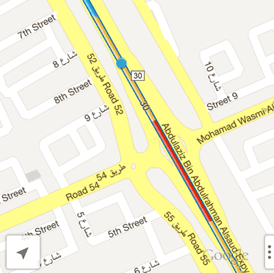
Forgot the date, but back when Kuwait celebrated 50 years of its Constitution, I was driving down the 30 from Salmiya to the Kuwait City. With the traffic getting thick, I told my wife to switch to Google Maps/ traffic and my phone (Google) took me to the Dar Al Awadi building (my destination) in about 14 minutes.
Friends that left home 20 minutes earlier were struggled for a while and then just went back home!