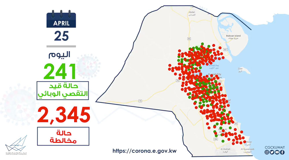
The Center For Government Communication released a visualization of how Covid-19 spread across Kuwait. Looks like Salmiya is safe 😅
Source @cgckuwait
Thanks xbs
 2:48AM - Entertaining Kuwait since 2003
The Center For Government Communication released a visualization of how Covid-19 spread across Kuwait. Looks like Salmiya is safe 😅
Source @cgckuwait
Thanks xbs
9 replies on “Visualizing the Spread of the Coronavirus in Kuwait”
I don’t think it’s really a geographical visualization. It seems more like a speed of transmission visualization.
Wow, I never knew north Kuwait is full of people, and covid…
From what I could see in the map, The virus is more or less evenly spread throughout Kuwait. Maybe soon they will give us data based on area?
i don’t think the map is actually accurate
Dear Sir, we are at the lock dwon, we are cant not go out side we have no food, please help me we are to muce people
Habeebi who is your manager or previous manager or the HR in your company? Please contact them and tell them about your problem. From what I understand Direct Aid (العون المباشر) is providing food to people in Jleeb and Mahboula daily. Did you not receive anything from them?
Yep this map isn’t accurate, I thought it would be. From a cursory glance you can see that a lot of the points are actually in the desert.
If you have a better understanding of maps then you can figure out the area where the airport should be & how many dots appear in the desert right around the airport and the deserted area between the airport and ahmadi.
Also, its almost as if jahra is more affected than jleeb & mahboula combined! 😀 May be they should’ve put jahra under lockdown instead :p
The map isn’t accurate. It looks beautiful yes. But they didn’t do it to show how the virus spread. It’s a poor choice of visualization 😅. Why use a map if the geographical factor isn’t what you want to emphasize? 🤷🏻♂️
It would be helpful to know the locations of the daily infections as well. So that people are more careful in those areas.