
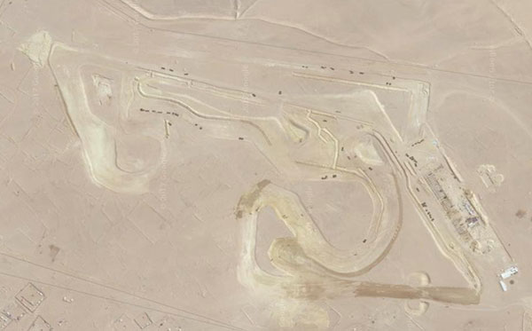
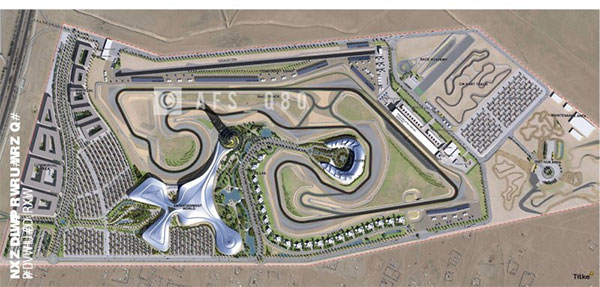
The Kuwait Motor Town Race Circuit is expected to be completed sometime next year but you can already see the layout of the track from space using Google Maps. You can compare the satellite view from top to the rendering below for a better idea of what you’re looking at.
For some reason the track doesn’t show when using a desktop browser but only when accessing the coordinates from your phone. I guess the desktop version of Google Maps isn’t updated yet. So if you want to see the track from your phone, click [Here]
3 replies on “Kuwait Motor Town Race Circuit from Space”
You can see it in wikimapia https://wikimapia.org/#lang=en&lat=28.928242&lon=48.145781&z=15&m=b
Reading this on a desktop in the office and can see the sat-image just fine.
You may now also see the layout of the new airport, which is forming into a nice thong.