If you live outside of Kuwait and were trying to access the blog over the past few days you might have noticed a Cloudflare page or a Captcha page before access the blog. That’s because my blog was under a DDoS attack and so I had to increase security to block the attack.
Last week I got the following email:
DDOSIng ur website
hello i am going to be your senpai today and treat you really well mark-chan.
so recently my whoremones are really high but not my pockets.
email me back for the amount to be paid.
buh-bye
I didn’t really think of it much, I definitely wasn’t going to pay the person and figured if they did manage to bring down the blog that it wouldn’t be an issue. If the blog went offline it would mean I wouldn’t have to post so it would be a mini-vacation of a sort. Over the next few days, my blog got hit with close to a billion requests!
For those of you who don’t know what a DDoS attack is, it’s when an attacker sends an overwhelming amount of traffic to a website which would then either slow down the site to a crawl or bring it down completely. My blog gets around 10,000 visitors a day give or take but just like that I started getting millions of visitors per hour. It was insane!
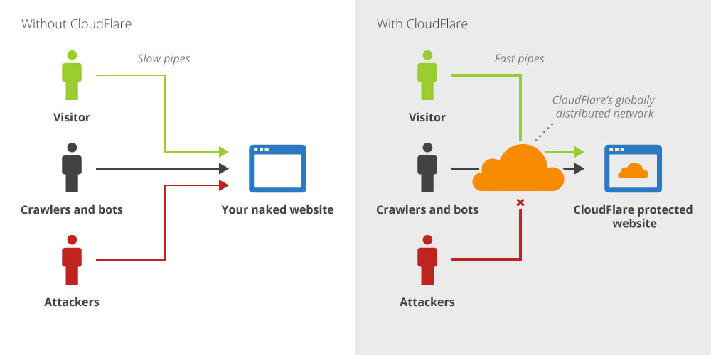
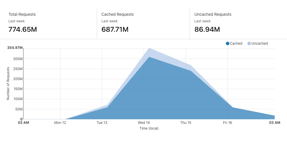
Luckily for me, all my blog traffic is routed through a service called CloudFlare. I actually did that a couple of months ago when some readers using STC were having difficulty accessing my blog, I figured that might solve the issue (it didn’t). But one of the benefits of CloudFlare is the ability to set up firewalls and extra security measures to block DDoS attacks. Over the next few days I watched CloudFlare spot and block attacks from all over the world, the numbers were just insane and impressive. In just a few days CloudFlare blocked nearly a billion requests, here are some numbers:
Total Requests: 774.65 Million
Total Requests Blocked: 638.32 Million
Total Bandwidth: 6.73 TB
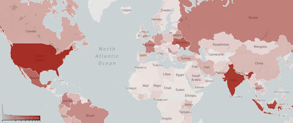
Top Threat Countries:
United States 108,540,196
India 76,169,029
Indonesia 68,455,987
Ukraine 47,789,199
Mexico 40,210,543
If I had set up CloudFlare properly from the start it would have blocked all the threats but it took me a few hours to realize what was going on and set up all my firewalls.
One benefit from all of this is that it taught me how to use CloudFlare properly and now I’ve actually managed to completely block all spam from the blog. Over the past weekend, not one single spam comment made it to the blog and that’s because any traffic coming from countries like India, China, Russia etc.. will now go through a security check to make sure they’re not bots.
So anyway, if you had difficulty accessing the blog this past weekend now you know why.